The Katsushika Ward is known among Tokyo's 23 districts for its nostalgic atmosphere in areas like Shibamata. Simultaneously, it comprises diverse regions such as Mizumoto Park in the Mizumoto neighborhood, which is the largest park among Tokyo's 23 districts, as well as redeveloping areas like Kinshicho and Shin-Koiwa.
Its old-town charm is well-recognized, securing the top spot in rankings such as "Districts You Think Retain Old-Town Atmosphere" (Netlab Research, 2022). Moreover, in the "Truly Livable City Awards" (Alhi Research, 2023), Shin-Koiwa ranked third in the Kanto region and first among the 23 wards, emphasizing its convenience to the city center and its overall quality of life, factoring in affordability of living expenses and rent prices.
Contributing significantly to establishing the image of "Katsushika as the epitome of old-town Tokyo" were the nationwide films like 'Tora-san' series and the nationally acclaimed manga 'KochiKame.' The depictions of the townscapes and human interactions in these works have etched a lasting impression in the minds of many.
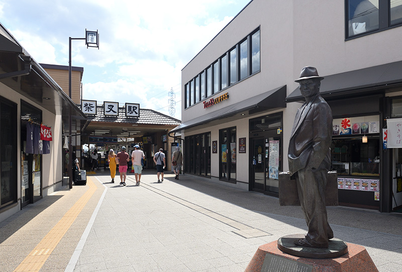
Shibamata Station, Home to the Statue of Tora-san from
Taishakuten Sando
■1 Prehistoric Katsushika Ward
In ancient times, Katsushika was beneath the sea. Subsequently, during the last glacial period, a global extreme cold and the consequent development of glaciers led to a decline in sea levels, creating land. The area that now encompasses Tokyo Bay, including Katsushika Ward, was characterized by a river called Ancient Tokyo River. It featured undulating terrain such as valleys and hills. With the onset of warming, the sea levels rose again, undergoing a process of submersion, transforming from land back to the seabed. Approximately 2,000 years ago, during the latter part of the Yayoi period, it became completely habitable for humans.
The oldest evidence of settlement in Katsushika is found at the "Gotenyama Ruins" in Aoto, dating back to around the 4th century. Discoveries such as weights for fishing nets called "circular soil weights" and traces of ridges used for planting crops indicate that both agriculture and fishing were practiced. By the 6th century, settlements had formed around Shibamata, Okudo, and Higashi-Shinkoiwa. The "Shibamata Hachimangu Shrine Tomb" is considered the oldest tumulus (burial mound) in the ward, thought to be the grave of a powerful figure from the latter half of the 6th century.
The Hachimangu Shrine Tumulus
Gotenyama Park
■2 The Katsushika Ward in the Middle Ages (Nara Period to Pre-Edo Period)
During the Heian period, Katsushika belonged to the "Katsushika District" in the Shimōsa Province, with "Ōshima-gō" constituting a part of the Katsushika Ward.
Throughout the Heian period, various estates (privately owned lands of aristocrats and temples) emerged in different regions. Within the area corresponding to Katsushika, a distinctive estate called "Kasai Mikuiriya" was established. This estate received protection for its territory by donating its products not to the central government but to the Ise Shrine. It engaged in rice cultivation, as well as the raising of cattle and horses, hemp cultivation, and the collection of medicinal herbs.
During the Nara and Heian periods, there was progress in road construction, connecting the central government with the regions. Maps confirm the existence of a road between Sumida in Sumida Ward, Katsushika in Tateishi, and Koiwa in Edogawa Ward, believed to have been part of the Tokaido Road. The presence of the place name "Ōdō" along this road further supports this theory.
In the 15th century during the Sengoku period, Kasai became a frontier for power struggles among warrior clans, resulting in the construction of "Kasai Castle" on Gotenyama in Aoto and the occurrence of the "Battle of Kozudate." In 1590, Kasai Castle was sieged and destroyed by Toyotomi Hideyoshi, a prominent military commander who achieved the unification of Japan and implemented various policies, including the Sword Hunt.
During the era of Kasai Castle, roads were developed connecting Odawara to Mito and Sakura, and at the junction, a post town called "Kasai Shinjuku" emerged.
Katsushika Castle Ruins Park
Scenery of the former Nakagawa (photographed in Edogawa Ward)
■3 Katsushika Ward During the Edo Period
Entering the Edo period, Katsushika shifted from the jurisdiction of Shimōsa Province to that of Musashi Province, and Kasai Mikuiriya became a territory under the control of the shogunate. Numerous flood control projects and irrigation developments took place within the territory, giving rise to new farmlands alongside waterways like the Kasai Aqueduct, the Kogo Aqueduct, and the Jōge Wataru Aqueduct.
The cultivated lands produced radishes, eggplants, cucumbers, scallions, turnips, and more. Leveraging the proximity of Katsushika to Edo, these vegetables were transported to the markets of Edo and held high regard among the populace.
During the Edo period, the traffic along routes like the Mito Road connecting Edo and Mito (in Ibaraki Prefecture) and the Sakura Road linking Edo and Sakura (in Chiba Prefecture) increased, leading to the prosperity of Kasai Shinjuku. Along the banks of the Edogawa River, the "Kanamachi Matsudo Sekisho" was established on the Mito Road, and the "Koiwa Ichikawa Sekisho" on the Sakura Road. These checkpoints particularly oversaw the inspection of "entering firearms and exiting females," referring to firearms being brought into Edo and noblewomen residing in Edo as hostages leaving the city.
At that time, not a single bridge existed, and travel across the Nakagawa and Edogawa rivers relied on ferries. One of the most renowned ferries was the "Yagiri no Watashi," famous even in folk songs.
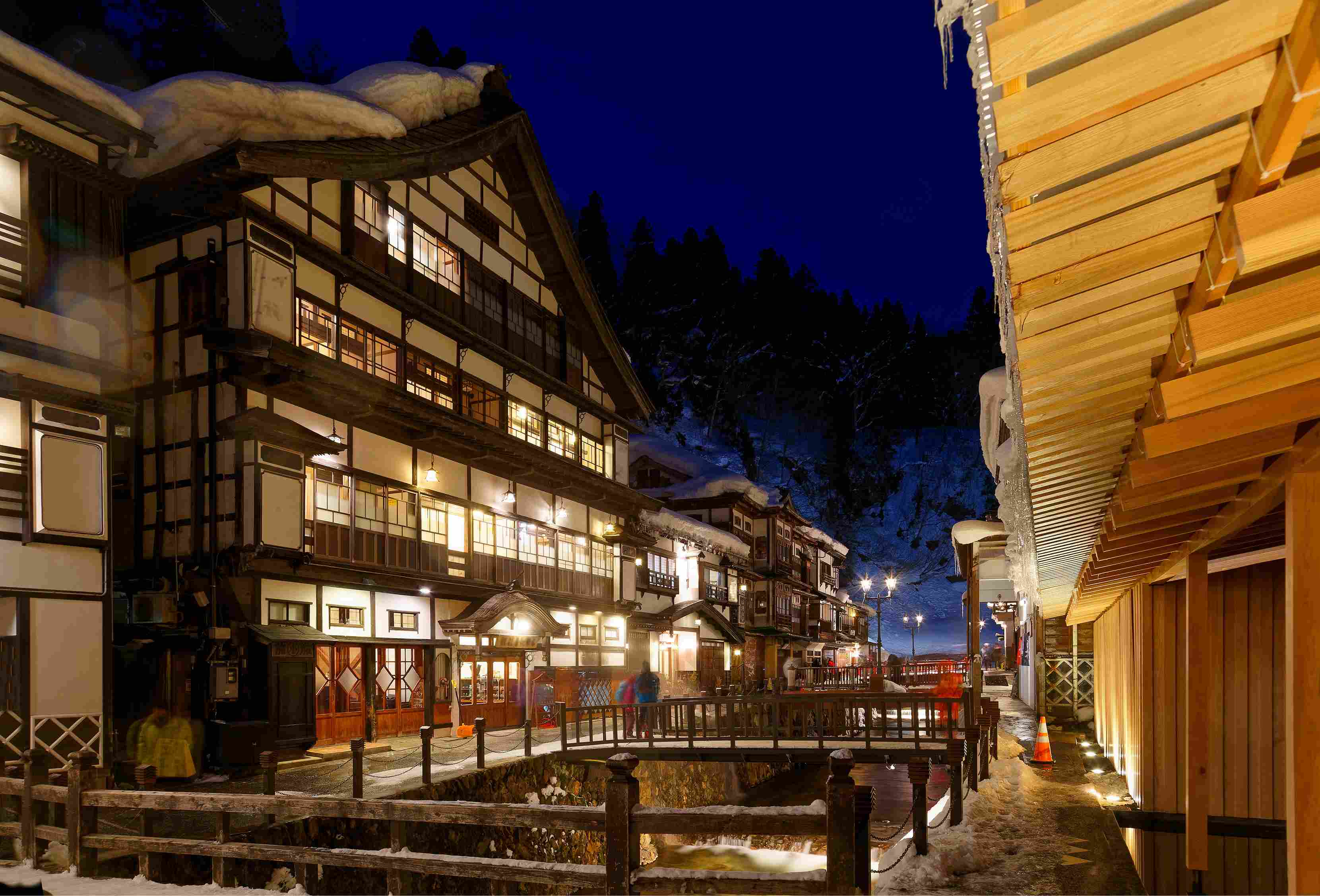
The primary attraction in Katsushika was the Shibamata Taishakuten, also known as "Daikyoji Temple." Pleasure boats pulled by ropes along the Hikifune River entertained tourists. By the end of the Edo period, two iris gardens, "Kodakaen" and "Musashien," emerged in Horikiri, making Katsushika a popular destination for relaxation and day trips among the Edo populace. "Kodakaen" was also a spot where the Tokugawa shoguns and their children stopped during falconry outings.
Taishakuten
Yagiri no Watashi
■4 The Katsushika Ward from the Meiji Era to World War II
Entering the Meiji period, Katsushika became "Nankatsushika District" within Tokyo Prefecture following the abolition of feudal domains in 1871. Agriculture remained a primary industry, yet the emergence of a new industry utilizing water transport—brick manufacturing—flourished. In 1872, the "Kosuge Brick Manufacturing Plant" was established in Kosuge, introducing the "Hoffman kiln" with engineers from England, marking Japan's inaugural modern brick factory. The high-quality bricks produced here were used in Ginza, transforming it into a district with a Western-like ambiance.
During the Taisho era, papermaking industries took advantage of abundant water resources and water transport. Notably, the "Nippon Paper Industry Kameari Plant" founded in 1913 and the "Mitsubishi Paper Nakagawa Plant" established in 1917 were large-scale factories. The former site of the "Nippon Paper Industry Kameari Plant" is now home to the "Ario Kameari" mall. The steam boiler used at the "Mitsubishi Paper Nakagawa Plant," known as the "Chikyu-gama," is still displayed in the "Niijuku Mirai Park."
Additionally, the "Senkuse Celluloid Factory" was established in Higashitateishi in 1914, and the "Sekiguchi Celluloid Processing Plant" in Shin-Koiwa in 1918. These laid the foundation for "Katsushika, the Town of Toys," producing numerous toys like "Licca-chan," "Tomica," and "Monchhichi," not only for Japan but also for the world.
In terms of transportation, bridges were constructed as the checkpoints were abolished in the Meiji period, and railway networks expanded. The first railway in Japan was inaugurated in 1872, connecting Shimbashi to Yokohama. The Sobu Line opened in 1894, the Joban Line in 1895, and in 1897, Kameari and Kanamachi stations were inaugurated as Katsushika's first railway stations. With the subsequent establishment of factories, the area evolved into a bustling town where many people lived and worked. After the opening of Kanamachi Station, the number of pilgrims to Shibamata Taishakuten increased. To improve transportation, the "Emperor Shaka Handcar Railway" operated, where people pushed passenger cars on rails between Kanamachi and Shibamata.
A significant project during the Meiji era in Katsushika was the "Arakawa Flood Diversion Channel." This channel bypassed the old Arakawa River (Sumida River), which frequently flooded until the Meiji period. The government acquired lands in the farming and residential areas of the three districts: Adachi, Katsushika, and Edogawa, leading to approximately 20 years of extensive construction. Many residents relocated for the project, necessitating building relocations. Railways and shrines were also moved. Upon completion, this waterway significantly contributed to reducing water-related disasters in central Tokyo.
As Katsushika's industries shifted from agriculture to industrialization, after the 1923 Great Kanto Earthquake, many people relocated to Katsushika. The area's favorable location for commuting to the city center and the availability of land previously used for rice paddies and fields for residential purposes attracted newcomers. Over five years from 1920 to 1925, Katsushika's population doubled. Leveraging this influx, the district's industries further expanded and became the backbone of its economy.
The Taishakuten Jinsha Tetsudō (Reference: Katsushika Local History and Astronomy Museum, Walking Expert in Railway)
The
■5 The Postwar Katsushika Ward
Katsushika, largely spared from significant air raid damage during the war, embarked on swift reconstruction. Evacuees from the city center began settling in areas around the Koiwa, Kameari, and Tateishi stations, leading to the emergence of black markets and the formation of commercial districts.
Industries experienced an overall surge, with the number of factories in the ward escalating drastically from 1,017 in 1950 to 4,736 in 1970. While metal-related factories were the most prevalent, Katsushika cultivated its own unique industry, notably in toy manufacturing.
As industrial growth surged, so did the ward's population. Enormous public housing estates were developed in areas like Aoto and Koiwa. Katsushika's population, which stood at 290,000 in 1955, soared to 470,000 by 1970.
In the wake of the 1990s bubble burst, there was a significant shift of factories to the outskirts or overseas. Parks, commercial facilities, and apartments began cropping up on the vacated factory sites. Ariake Mall now stands on the former site of Nippon Paper Industry in Kameari, while Niijuku Mirai Park and Tokyo University of Science now occupy the former Mitsubishi Paper Company site in Kanamachi. Multiple apartment buildings also sprouted across these areas.
The Monchhichi Park with a Monument of the 'Monchhichi,' released by 'Sekiguchi' in 1974, in Shin-Koiwa
The Shin-Koiwa Shopping Street
■6 The Future of Katsushika Ward
In the past decade or so, Katsushika Ward has undergone significant transformation, primarily with the construction of numerous apartment complexes on former factory sites, reshaping the area into a residential hub. This trend is poised to accelerate further, with extensive development plans underway, including large-scale condominium construction, redevelopment of station surroundings, and enhancements to commercial areas and transportation hubs.
Notably, ongoing redevelopment around Kanamachi Station and the upcoming revitalization of Shin-Koiwa Station exemplify this trend. At Kanamachi Station, development will primarily progress in the northern precincts, envisioning a new urban landscape connecting Niijuku Mirai Park and Kanamachi Station.
Around Shin-Koiwa Station, the ward's largest redevelopment project is planned, slated to feature condominiums, commercial facilities, and parks. As accessibility and convenience around the station improve, new facilities with fireproofing and earthquake resilience will address the aging infrastructure and disaster preparedness challenges.
Moreover, by creating open spaces, vibrant community activities are expected to flourish, fostering a diverse intergenerational interaction, aiming to evolve into a comfortable, interconnected community.
Over the next few decades, Katsushika's cityscape will undergo substantial changes. However, amidst this evolution, the cherished charm of the traditional downtown scenery and its essence will likely remain preserved. Thus, the neighborhood's warm and communal spirit will continue to endure. The future Katsushika aspires to be an appealing destination as a clean, livable, and welcoming community.
Taishakuten Approach
■7 Traditional Culture Mini Column:
One of Japan's summer icons, the "yukata," written as "浴衣," was originally worn indoors after bathing. Its transition to outdoor attire began with the emergence of a dyeing technique called "Chusen" during the Meiji era.
This new technique enabled the manual mass production of vividly colored fabrics, solidifying the yukata as a "summer fashion statement." While Chusen dyeing spread nationwide, the ones produced in the Kanto region were particularly known as "Tokyo Honzome," mainly manufactured in Katsushika, Edogawa, and Adachi wards.
The yukata made with Tokyo Honzome can be found in longstanding kimono shops across the country. Opting for "Tokyo Honzome" ensures the enjoyment of the unique beauty derived from traditional techniques. For those seeking a more casual experience, a visit to the "Tokyo Wasaiso Creation Center" in Tateishi, Katsushika Ward, allows purchasing Honzome hand towels or even trying out Chusen dyeing.
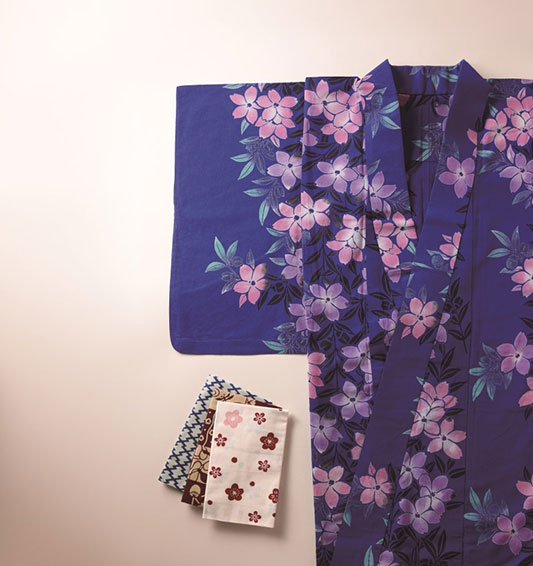
Tokyo Honzome